Geodetic Observatory

Purposes

The Italian Geodetic Observatory in Antarctica focuses on the establishment and maintenance of the geodetic framework in Antarctica, in order to provide measurements and analysis for the characterization of neo-tectonic of a large area of Northern Victoria Land. The Observatory is based on continuous GNSS (Global Navi
gation Satellite System) measurements, for the definition of a three-dimensional reference, and tide gauge measurements, for the definition of an absolute local and global elevation reference model. The GNSS measurements are carried out on 27 stations creating the VLNDEF network (Victoria Land Network for DEFormation control).
The VLNDEF observations are processed for scientific purposes by the IGOA itself as well as shared with further international centres. As an example visit the NGL - Nevada Geodetic Laboratory website, that includes IGOA stations and data withihn the global network. For accessing the time series of VLNDEF stations, please visit the NGL GPS Networks Map.
Framework
Originally the Geodetic Observatory was constituted by a continuous GPS station (TNB1) and a tide gauge, both installed in the area of the MZS (Mario Zucchelli Station) base. Later, a second continuous GNSS station (TNB2) was installed nearby the base. In order to define a most reliable geodetic reference, a GNSS network of long term continuous stations is required. Hence, two seasonal continuous GNSS stations (VL05 and VL18) were monumented in remote sites, followed by the installation of some other continuous stations, also thanks to the collaboration to national and international projects.
This section describe the framework of the Italian Geodetic Observatory in Antarctica and the specifications of collected data.
TNB1 and TNB2 continuous GNSS stations
There are currently two continuous GNSS stations, TNB1 and TNB2, nearby the Italian base MZS (Mario Zucchelli Station). Collected data, in RINEX format, are sent daily in Italy and are available for download at the Database page of this website.
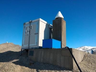
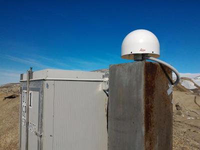
TNB1 continuous GPS station was monumented during the 1997-1998 campaign on a granite outcrop. It was originally equipped with an Ashtech Z-12 GPS receiver and an Ashtech 700936D Dorne Margolin antenna with chokering. Installed on a concrete pillar, TNB1 continuously collected data of the GPS constellation for about 17 years. In November 2015, the instrumentation was completely renewed. Currently, the station is equipped with a Leica GS25 GNSS receiver and a Leica AT504 Dorne Margolin antenna with chokering. TNB1 collect data of GPS and GLONASS constellations.
| |
|
|
TNB1 continuous station monumentation
| |
TNB1 new instrumentation, operating since november 2015
|
|
Position
|
ITRF2000 epoch 2003.0
| |
Latitude
|
74° 41' 55,69965" S
| |
Longitude
|
164° 06' 10,58957" E
| |
Ellipsoidal height
|
72,27 m
| | | |
Data specification
| | |
Session length
|
24 h
| |
Acquisition rate
|
15 s
| |
Elevation angle
|
3°
| |
|
 TNB2 continuous station monumentation
|
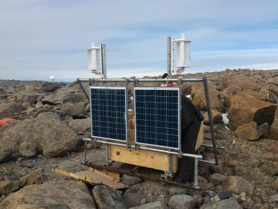
TNB2 continuous GNSS station was monumented during the 2007-2008 campaign on a granite outcrop. Equipped with a Topcon GB1000 GNSS receiver and a Topcon CR-G3 chokering antenna, installed on a steel pillar, TNB2 collects data of GPS and GLONASS constellations, currently with the same configuration of TNB1. |
Position
|
ITRF2000 epoch 2003.0
| |
Latitude
|
74° 41' 56,14134" S
| |
Longitude
|
164° 06' 10,11967" E
| |
Ellipsoidal height
|
71,071 m
| |
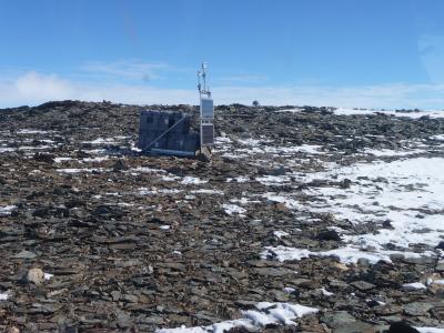
VL05 and VL18 seasonal continuous GNSS stations
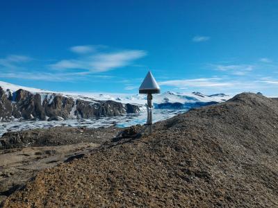
Two seasonal continuous stations were monumented at remote VLNDEF (Victoria Land Network for DEFormation control) vertices VL05 (Cape Phillips) and VL18 (Starr Nunatak). That stations collect data starting from the MZS opening period (the end of October), until the depletion of power supplied by solar panels and backup batteries (generally the end of March).
Both the stations are monumented on granite outcrops. Equipped with Tocpon GB 1000 GNSS receivers and Topcon CR-G3 chockering antennae, installed on steel pillars, the stations collect data of GPS and GLONASS constellations, currently with the same configuration of TNB1.
There is no a satellite communications device and collected data are available for download at the Database page of this website, in RINEX format, starting from march of the year following the year of logging.
| |

|
|
Monumentation of VL05 at Cape Phillips
| |
Monumentation of VL18 at Starr Nunatak
|
|
Position
|
ITRF2000 epoch 2003.0
| |
Latitude
|
73° 03' 47,05152" S
| |
Longitude
|
169° 36' 43,87748" E
| |
Ellipsoidal height
|
478,493 m
| | | |
Position
|
ITRF2000 epoch 2003.0
| |
Latitude
|
75° 53' 54,71732" S
| |
Longitude
|
162° 35' 37,36182" E
| |
Ellipsoidal height
|
58,011 m
| |
VL01, VL12 and VL30 continuous
GPS
stations
In 2014, thanks to a collaboration with
UNAVCO
(University NAVstar COnsortium), in the context of
POLENET
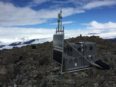
(POLar Earth observing NETwork) - ANET (Antarctica NETwork monitoring) project, three VLNDEF (Victoria Land Network for DEFormation control) points, VL01 (Tombstone Hills), VL12 (Monte Cassino) e VL30 (South Mount Bruce), were equipped with GPS continuous station and a satellite communication device in order to make collected data available to download at once.
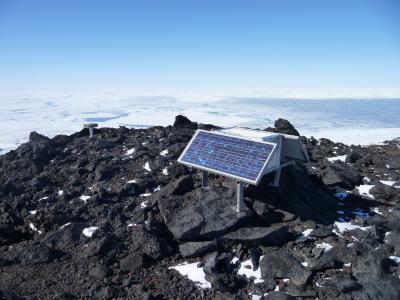
The three stations are monumented on granite outcrops and are powered by solar panels and a set of backup batteries. The instrumentation consist of Trimble NETRS GPS receivers and TRM59800.00 (radome SCIS) chockering antennae, installed on steel pillars, and collect data of GPS constellation. Such data have currently the same specifications of TNB1 data, except for the acquisition rate, set as 30 s.
| |
| |
|
|
VL01 monumentation (Tombstone Hills)
| |
VL12 monumentation (Mount Cassino)
| |
VL30 monumentation (South Mt. Bruce)
|
|
Position
|
ITRF2000 epoch 2003.0
| |
Latitude
|
72° 27' 00,49337" S
| |
Longitude
|
169° 43' 30,25310" E
| |
Ell. height
|
596,919 m
| | | |
Position
|
ITRF2000 epoch 2003.0
| |
Latitude
|
72° 16' 27,98421" S
| |
Longitude
|
169° 43' 37,19134" E
| |
Ell. height
|
1932,975 m
| | | |
Position
|
ITRF2000 epoch 2003.0
| |
Latitude
|
70° 35' 55,39560" S
| |
Longitude
|
162° 31' 30,51127" E
| |
Ell. height
|
1491,517 m
| |
INXP and LRSN continuous
GNSS
stations
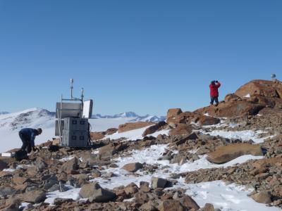
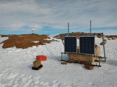
In 2016, thanks to a collaboration with the Observations and Analysis of Earth and Climate Laboratory of ENEA TPSS (Territorial and Production Systems Sustainability) department, in the context of MALOX (MAss LOss in wind fluX) projects, two new GNSS continuous stations were monumented at remote sites, INXP (Inexpressible Island) and LRSN (Mount Larsen), powered by solar panels, wind generators and a set of backup batteries. Due to MALOX project requirements, it was not possible to monument INXP station on a granite outcrop. The analysis of collected data will give some informations about its stability.
Both stations are equipped with Tocpon Net-G3 GNSS receivers and Topcon CR-G5 (radome TPSH) antennae, installed on steel pillars, and collect data of GPS and GLONASS constellations, currently with the same configuration of TNB1, except for the acquisition rate, set as 30 s.
There is no a satellite communications device and collected data are available for download at the Database page of this website, in RINEX format, starting from march of the year following the year of logging.
| |
|
|
Monumentation of INXP at Inexpressible Island
| |
Monumentation of LRSN at Mount Larsen
|
|
Approximate position
|
WGS84
| |
Latitude
|
74° 56' 55,1" S
| |
Longitude
|
163° 41' 06,3" E
| |
Ellipsoidal height
|
32 m
| | | |
Approximate position
|
WGS84
| |
Latitude
|
74° 57' 02,0" S
| |
Longitude
|
161° 46' 10,1" E
| |
Ellipsoidal height
|
948 m
| |